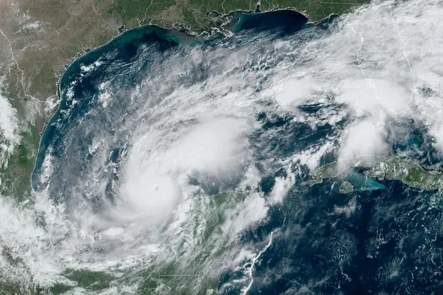
They have not yet recovered from the deadly Hurricane Helene, and the residents of Florida are already facing a new threat. It is expected to hit the coast of Florida on Wednesday night. Hurricane Milton could be deadlier than Hurricane Helene, which claimed over 220 lives across several states last week.
On Sunday afternoon, the hurricane was classified as a tropical storm but ‘exploded’ and rapidly strengthened into a Category 5 storm, with winds exceeding 280 kilometers per hour. NASA captured images of the storm from space.
A state of emergency has been declared in Florida, and authorities have issued serious warnings to residents to heed evacuation orders. About 3.3 million people live in the Tampa Bay area.
Residents of the most vulnerable parts of Tampa Bay and other areas along Florida’s west coast have less than a day to evacuate.
- “If the storm stays on its current path, it will be the worst storm to hit the Tampa area in over 100 years,” warned the National Weather Service in Tampa. The Florida Emergency Management Agency is preparing for the largest evacuation since 2017.

Long queues are forming at gas stations, many of which have run out of fuel, and traffic jams are stretching for miles.
People have been urged to take the danger from Milton seriously.

- “There’s no other way to put it. Over the next few days, Tampa Bay will face the biggest hurricane to hit it in 100 years,” warned Pinellas County Emergency Management Director Cathie Perkins.
Tampa Mayor Jane Castor told CNN that “if people decide to stay, they will die.”
- “If you want to challenge Mother Nature, she wins 100% of the time,” she added.
On Monday, Florida Governor Ron DeSantis said all debris left behind by Hurricane Helene must be cleared. Milton could easily turn that debris into projectiles and injure many people. Hundreds of vehicles were clearing the streets on Sunday.
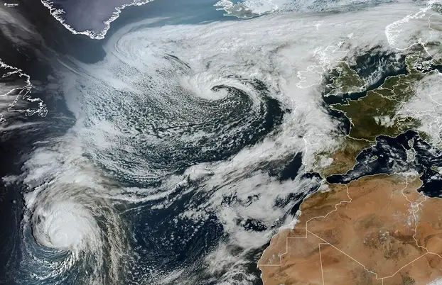
Hurricane Kirk, currently moving toward Europe, peaked as a Category 4 hurricane in the central Atlantic, with winds exceeding 230 kilometers per hour.

It is expected to weaken to Category 1 by Monday as it moves northeast, leaving warm waters behind. Over the next few days, Kirk will undergo extratropical transition, losing its hurricane status as it reaches European shores by Tuesday or Wednesday, reports the Guardian.
There is no absolute certainty about the exact path of this extratropical cyclone in meteorological models, but it is forecasted to move over northern Europe.
France, Belgium, the Netherlands, and northern Germany are expected to experience strong winds and heavy rains. If the system shifts slightly northward, the southernmost parts of the United Kingdom could also be affected.
Several hurricanes are currently being monitored by meteorologists, with special attention on Hurricane Leslie. Located in the central Atlantic, Leslie was upgraded to a Category 1 hurricane on Saturday, with maximum winds of around 145 km/h by Sunday evening. However, it is expected to weaken to a tropical storm by Tuesday morning, and forecasts suggest it will not make landfall, thus not causing damage to the coast.
